Walking in the mountains is an excellent form of physical activity, which provides close contact with nature. The picturesque surroundings of Szczyrk are ideal for hiking. Well marked and varied trails offer beautiful views that will delight anyone. Here is an overview of the three most interesting routes for hikers, in our opinion!
From the Salmopol Pass to Skrzyczne
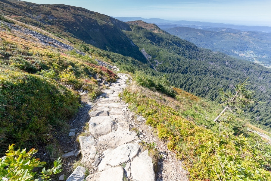
Our list opens with a route to the highest peak of Beskid Śląski, i.e. Skrzyczne, 1257 m above sea level. You can get to the top not only on foot but also by train from Szczyrk. However, those who complete the peaks belonging to the Crown of Polish Mountains have several trails to choose from – including the red trail we recommend and then the green one from the Salmopol Pass (Biały Krzyż). This one, although slightly longer than the others, offers by far the most picturesque views. On the way, there is a stop at Malinowska Skala. The hardships of the trek will be rewarded by the unique panorama of the Beskid Śląski, Beskid Żywiecki, Tatra Mountains – both Polish and Slovak and even Mala Fatra. At the top, there is also the PTTK Skrzyczne mountain hostel, an observation deck, the upper cableway station and the Radio and Television Broadcasting Centre with a characteristic mast.
Length: 7.9 km
Walking time: 2h45min
Route preview on the Tourist Map
To Klimczok and Błatnia with a stop at Uncle Tom’s Cottage
Another trail worth following while staying in Szczyrk leads to Klimczok (1117 m), which is the highest peak located in the northern part of the Silesian Beskid. We start the trip in the very centre of the town, and after a short while, we start a steep, rocky, but not very long climb through the forest. Following the yellow trail, you will reach Uncle Tom’s Cottage, a shelter on the Karkoszczonka Pass. A stylish highlander cottage, arranged in an old plantation from 1918, is an ideal place for a short stopover. Afterwards, continue along the red trail towards Siodlo pod Klimczokiem. From here, return to the yellow trail and hike through Trzy Kopce pod Klimczokiem to reach the PTTK mountain hostel on Błatnia.
Length: 10.2 km
Walking time: 3h47min
Route preview on the Tourist Map
PTTK Szyndzielnia via Siodło pod Klimczokiem
The ranking closes with a slightly shorter, though no less scenic, the blue trail to Klimczok with a visit to the PTTK Szyndzielnia mountain hostel. Similarly to the other trails, you start in the centre of Szczyrk. At the height of the slalom slope, the trail turns right into Wrzosowa Street to start climbing up the bends up to the Na Górce Sanctuary, located at 670 metres. From here, there is a view of Skrzyczne. Going further in the north-western direction, you ascend along a forest road directly to Siodlo pod Klimczokiem. Less than several dozens of meters above the pass, in an eastward direction, there is Klimczok Hostel. However, we continue the route north along the red trail leading to the PTTK Szyndzielnia Mountain Hostel.
Length: 6.6 km
Walking time: 2h40min
Route preview on the Tourist Map